
Some hikes do not need to reach 3,000 metres to give you a genuine mountain day. The Croix de la Porcière is one of them.
Starting from the hamlet of Le Pré, above Tincave, this loop first crosses a beautiful mountain forest, gradually reaches more open ground, then arrives at a natural balcony just over 2,000 metres. You are on the heights above Bozel and Tincave, facing the peaks of the Vanoise.
David walked the loop for Ma Passion Montagne and brought back the photographs in this article. His verdict is simple: a steady climb, magnificent panoramas, and a descent where a few steeper sections call for care. We rate it moderate — we explain why below.
Family profiles: Adventurous & Discovery
| Season: Summer
| Trailhead: Le Pré, above Tincave
| Difficulty: Moderate
At a glance — about 8 km, +650 m of ascent and 3 h to 3 h 30 of walking, with a high point around 2,075 m at the Croix de la Porcière.
The route at a glance
| Trailhead | Le Pré, above Tincave — about 1,425 m |
|---|---|
| Route | Le Pré → La Duy (1,550 m) → La Rotte (1,600 m) → Crêt du Feu → Croix de la Porcière → Bois de Tincave (1,580 m) → Le Pré |
| Type | Loop |
| Distance | about 8 km |
| Ascent | about +650 m (655 m per the reference guide) |
| Duration | 3 h to 3 h 30 of walking |
| Crêt du Feu | 2,044 m |
| High point | Croix de la Porcière, about 2,075 m |
| Ma Passion Montagne grade | Moderate — no technical difficulty, but real ascent and a steep descent |
| Waymarking | Plenty of directional signposts, clear paths |
| Season | Snow-free months, depending on conditions |
| Dogs | Grazing herds and livestock guardian dogs are possible: keep your dog on a lead |
These figures match the Altituderando reference guide for the Crêt du Feu loop from Tincave (8 km, 655 m of ascent, 3 h to 3 h 30). David’s own outing came to roughly +650 m over 3 h 30 of walking. Timings always depend on your pace and your breaks.
From Le Pré to La Duy: starting in the shade
The walk begins near Le Pré, a small hamlet above Tincave at about 1,425 metres. The climb starts gently towards La Duy (1,550 m), and the forest closes in quickly — a real pleasure when the sun is baking the valley below.
The name La Duy means “the spring” in the local patois, something the Bozel valley tourist office also notes on its official La Duy loop. As you gain height, the forest starts to open onto the first glimpses of the mountains.
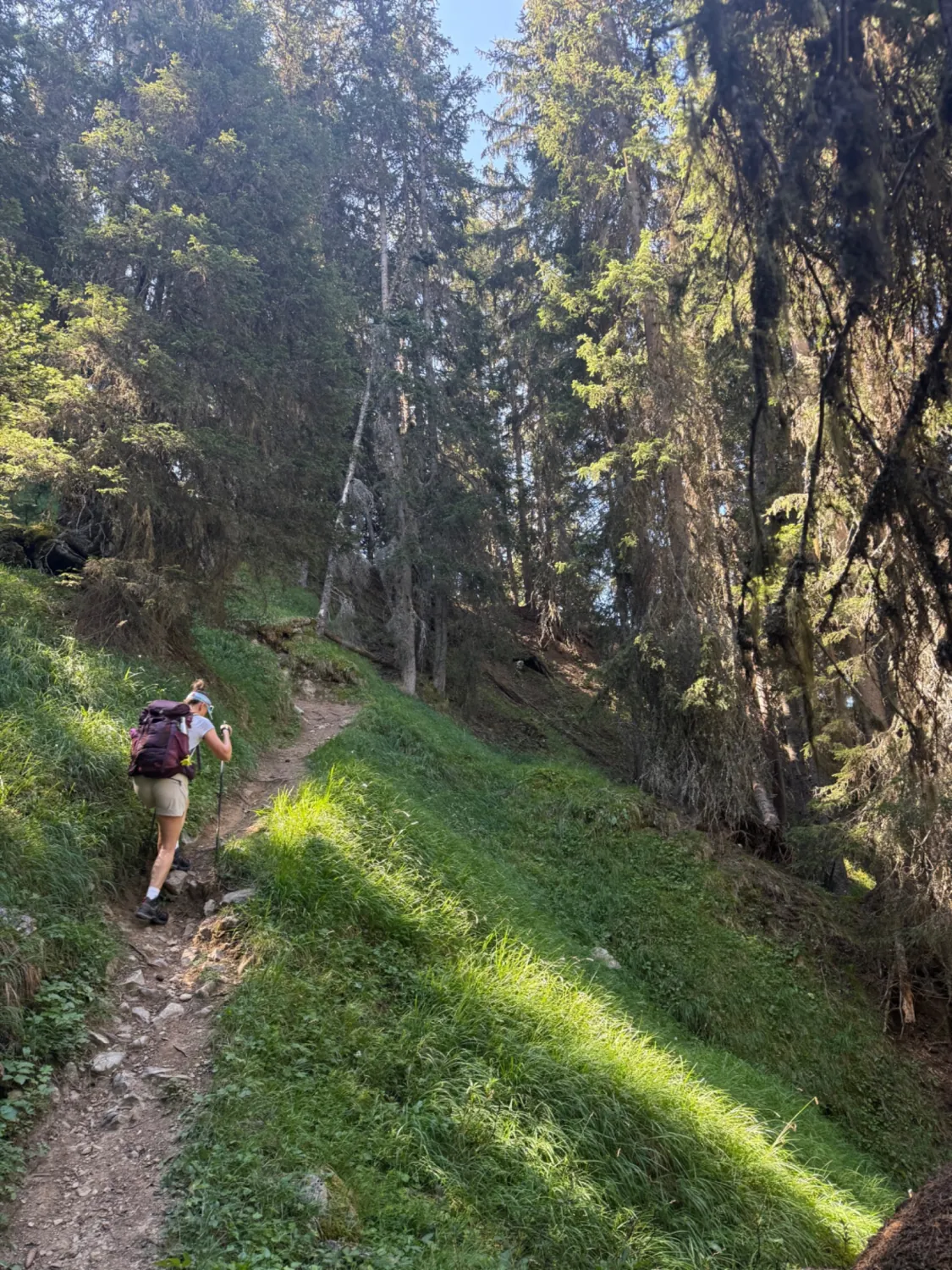
A forest that opens up little by little
Part of the charm of this hike is the way the landscape reveals itself. You do not step abruptly out of the trees into a vast pasture: the panoramas appear gradually between the trunks.
Small windows onto the valley grow wider and wider, until they open into broad views over the ridges surrounding Bozel and the peaks of the Vanoise.
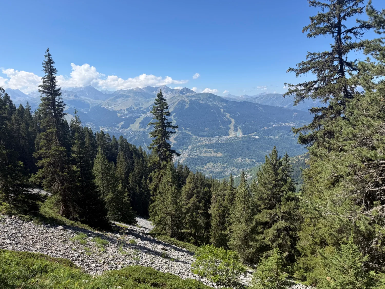
It is also a hike that rewards going slowly: watching the forest change with altitude, looking out over the pastures, trying to name the summits.
Towards the Crêt du Feu
The reference route passes several waymarked junctions: La Duy, La Rotte (1,600 m), then the Mont de la Guerre signposts at around 1,730 and 1,850 metres, before the Crêt du Feu sector.
The Crêt du Feu tops out at 2,044 metres. A short detour reaches its little dome and a first fine panorama. It is not essential, but it adds an intermediate objective before the cross — and with children, two small goals usually beat one distant one.
The Croix de la Porcière: the reward
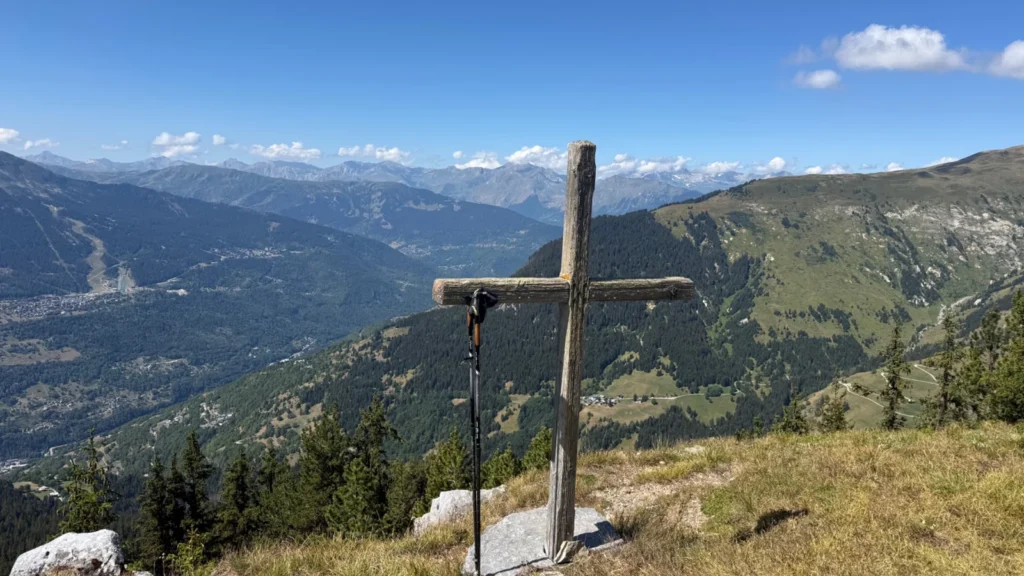
The Croix de la Porcière, at around 2,075 metres, is the high point of the day. A large wooden cross stands facing the valley and the mountains. This is the moment to drop the packs and get the picnic out.
The Altituderando guide lists views towards Les Encombres, the Grande Moendaz, the Pointe du Mont du Fut, the Cheval Noir and the Lauzière, along with Vanoise summits including the Grande Casse (3,855 m). From the cross you also look straight down onto the Bozel valley and, to the left, the Courchevel ski runs cut into the forest.
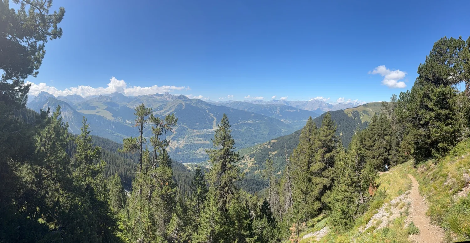
More broadly, this balcony position explains why the heights above Tincave and Bozel offer so many panoramic walks: you are just high enough to take everything in, without yet being in the high mountains.
A gateway to longer hikes
The Croix de la Porcière is not an isolated spot. The signposts along the way point to La Porcière, the Mont de la Guerre, the Chapelle du Bozelet, Mirabozon, La Cour and Tincave. The loop sits inside a much larger network of paths.
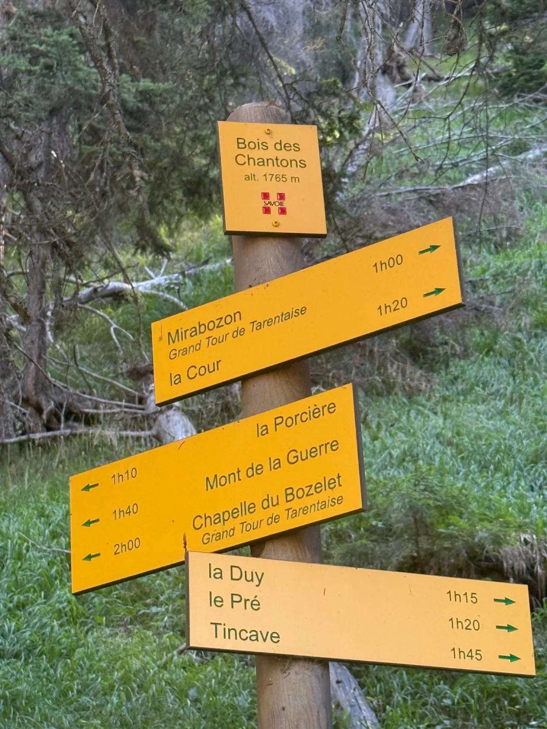
That is what makes the area rewarding over time: this loop can serve as a first step before longer outings towards the Mont de la Guerre or the Mont Jovet ridges. Speaking of the Mont Jovet, its history is worth a read — see the Mont Jovet forest and the 1904 Bozel disaster.
The return through the forest: steeper in places
After the cross, the character of the hike changes. The path crosses a combe then drops back into the forest to the Bois de Tincave (1,580 m). The reference guide flags a steep gradient and a descent in tight zigzags with a few sustained sections.
That is exactly why we prefer to call this a moderate hike rather than an easy stroll — even though Altituderando grades it “easy” in technical terms. On dry ground there is no real difficulty. With children, or after rain, you need to take your time on the steepest parts. Poles spare the knees and make the descent safer.
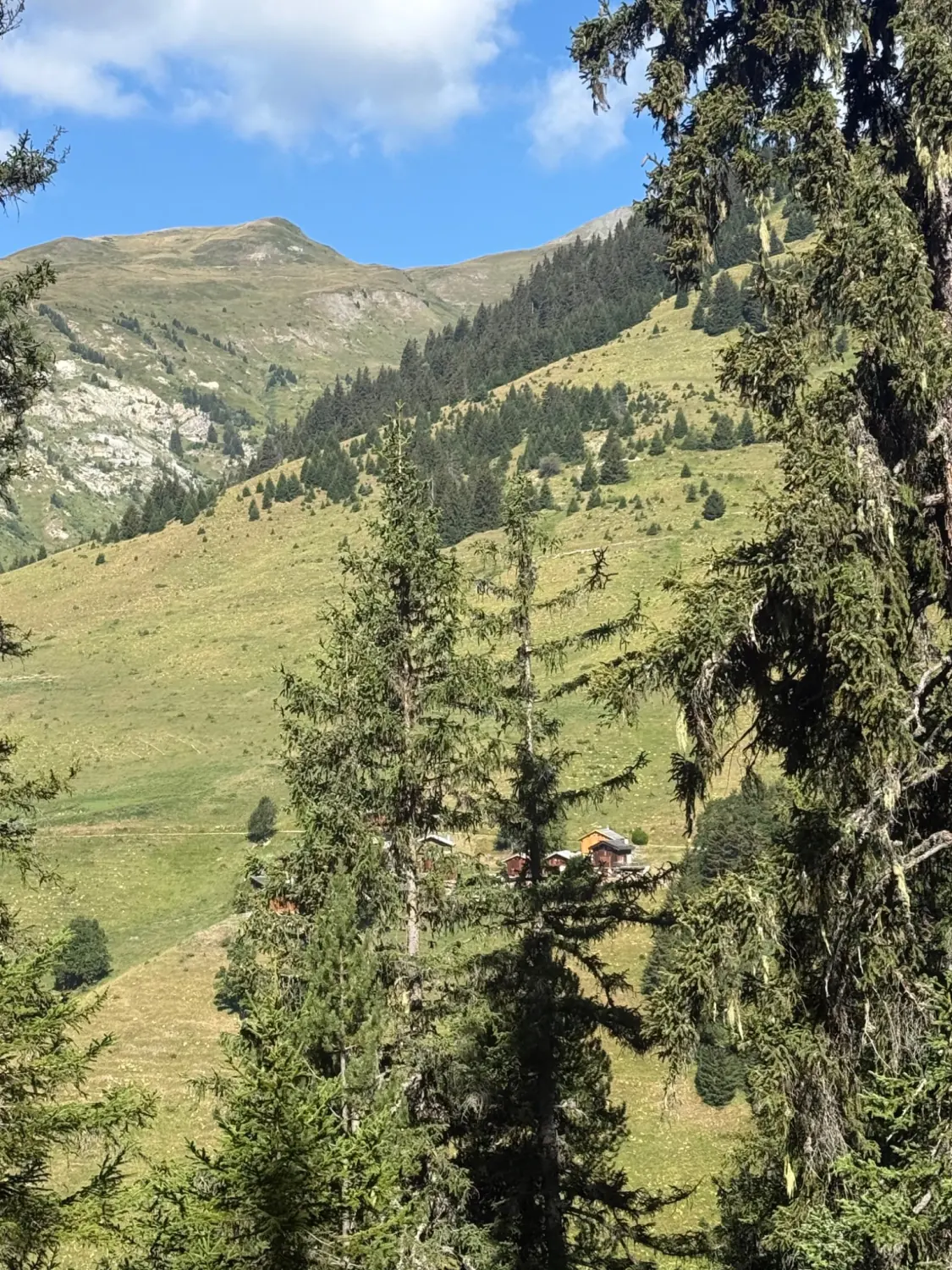
In a few hours the loop takes you through several very different worlds: hamlets, forest, high pastures, mountain panoramas, then back under the trees.
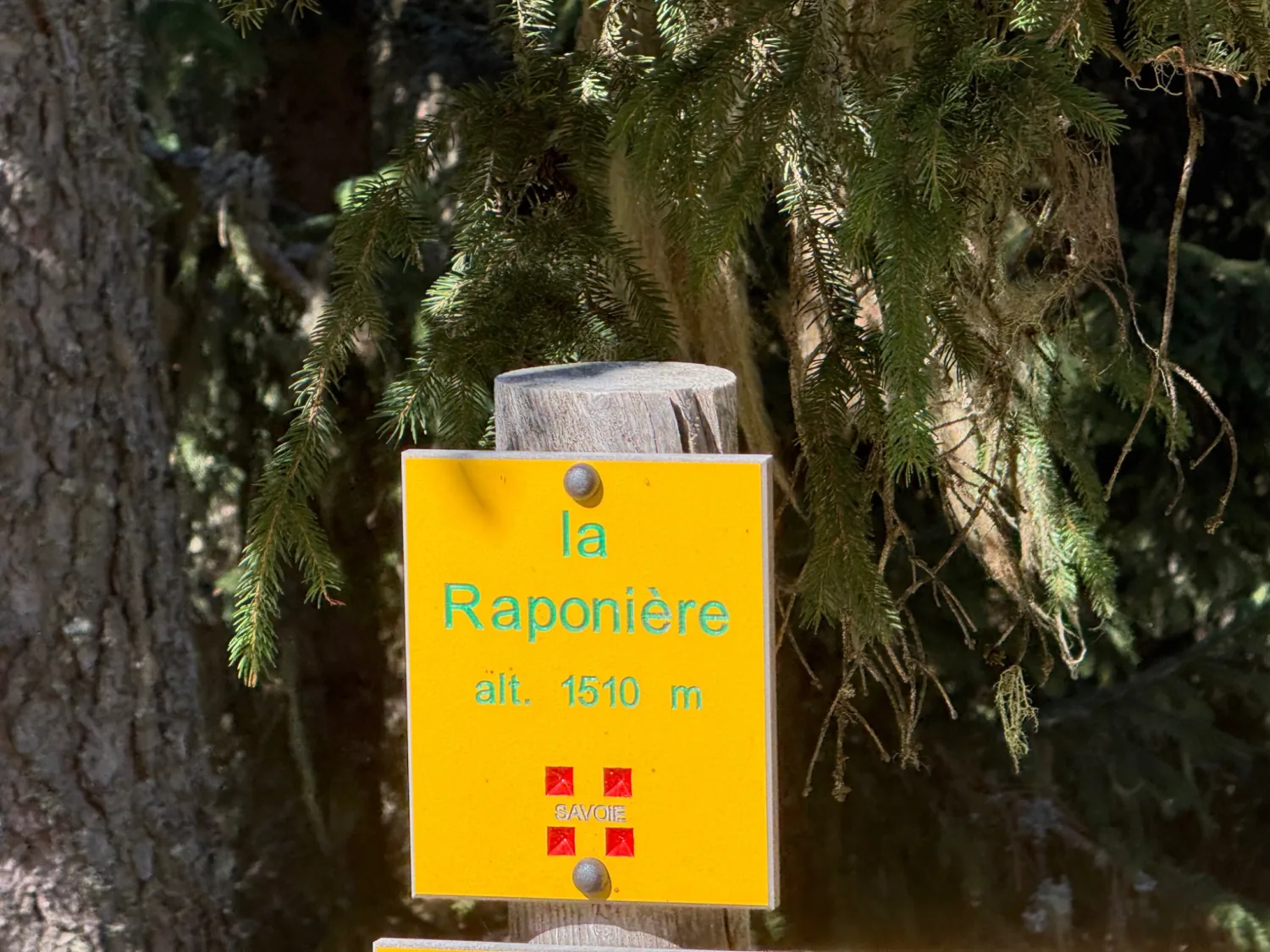
These landscapes are part of the valley’s identity: the mountains here are not only wild space, they are also a territory long shaped by livestock farming, high pastures, paths and small hamlets.
Which family profile is it for?
Adventurous family
★★★★★
The ideal profile for the full loop. The ascent, crossing the 2,000-metre mark and the sustained descent all add up to a proper mountain hike, without ever becoming technical.
Discovery family
★★★★☆
Excellent ground for it: watching the vegetation change, reading the signposts, working out the network of paths, learning to name the surrounding ridges. The cross gives children a clear goal to reach.
Contemplative family
★★★☆☆
The full loop already means 650 metres of ascent, so it is not our first choice for a purely restful outing — but a shorter walk around Le Pré or La Duy is enough to enjoy the forest and the views.
Can you do it with children?
Yes, if they are already used to walking. What matters is not so much the 8 kilometres as the 650 metres of ascent and the sometimes steep descent.
For a first mountain hike we would suggest something shorter — see our beginner routes around Bozel. For children or teenagers who already walk well, this loop becomes a very fine objective. As always, the real level depends far more on experience and motivation than on the age on the identity card.
And starting from Tincave?
This hike is especially convenient if you are staying in Tincave. The tourist office already publishes a La Duy loop starting from the village itself: 4.6 km, about +450 m, 2 h 30, with a high point around 1,720 m. It makes an excellent short version for less seasoned walkers.
⚠️ One thing to know about the La Duy loop: the tourist office flags a slightly narrow and vertiginous passage through the forest between Tincave and Châtelard. Nothing impassable, but worth knowing if you are walking with young children or if exposure bothers you. The loop is listed as open from 1 April to 30 November, depending on snow cover.
We may later work out a Ma Passion Montagne version starting directly from the chalet, with no need to take the car. We will not publish any distance, duration or ascent figure for that variant before walking it and recording it on GPS.
Our tips before you set off
- Proper walking boots with ankle support, above all for the descent.
- Plenty of water: there is nowhere to refill on the loop.
- Sun protection — the open sections above the forest are exposed.
- A warm layer even in summer, plus a jacket against wind or rain.
- A charged phone, and a map or offline track: the path network is dense and there are many junctions.
- Poles, genuinely useful on the steep descent.
- Check the forecast before you go and avoid exposed ground if storms are expected.
- Grazing herds and livestock guardian dogs may be present: keep your dog under control and on a lead where asked.
What we liked
- A genuine loop, not an out-and-back on the same path.
- The shaded forest, precious on hot days.
- The way the landscape builds, opening gradually rather than all at once.
- A clear objective above 2,000 metres, and a cross you have to earn.
- How close it is to Tincave: no long drive needed.
This is exactly the kind of hike we like to share: within reach of regular walkers, sporting enough to create real memories, and full of landscape.
Frequently asked questions
Where is the Croix de la Porcière?
On the heights above Bozel and Tincave, in Savoie, at around 2,075 metres, facing the peaks of the Vanoise.
How long does the hike take?
Allow 3 hours to 3 h 30 of walking for the loop from Le Pré, not counting a long picnic stop.
How much ascent is there?
About 650 to 655 metres of ascent, over a distance of roughly 8 kilometres.
Is the hike difficult?
There is no major technical difficulty in dry conditions, but the ascent is significant and some sections of the return are steep. Ma Passion Montagne grades it moderate.
Can you do this hike as a family?
Yes for a family already used to hikes with real ascent. For young children or beginners, the shorter La Duy loop is a better fit.
Can you start directly from Tincave?
Yes, the path network links Tincave to La Duy and the heights above. The tourist office publishes a La Duy loop of 4.6 km with 450 metres of ascent from the village.
When is the best time to go?
Outside the snowy months, depending on conditions. The La Duy loop is listed as open from 1 April to 30 November; for the 2,075-metre high point, wait until the snow has gone.
Explore further around Tincave and Bozel
- The Mont Jovet forest and the 1904 Bozel disaster — the history of the area you can see from the cross;
- Our easy hikes with children around Bozel;
- Watching marmots and mountain wildlife;
- Our ideas for things to do in Bozel in summer.
Staying near Bozel and Tincave?
The Le Pré trailhead is only minutes away, and the path network starts from the village itself. Discover our chalet as a base camp for your hikes.
Sources
- Altituderando — Crêt du Feu (2,044 m) loop from Tincave (distance, ascent, duration, altitudes, waypoints)
- Bozel Valley Tourist Office — La Duy loop (short version, meaning of “La Duy”, opening season, herds and guardian dogs)
- Field report and photographs: David / Ma Passion Montagne, August 2026.
Practical information last checked: August 2026. Trail conditions, snow cover and the weather forecast must be checked before every outing.
Ma Passion Montagne · Tincave, Bozel · Savoie