
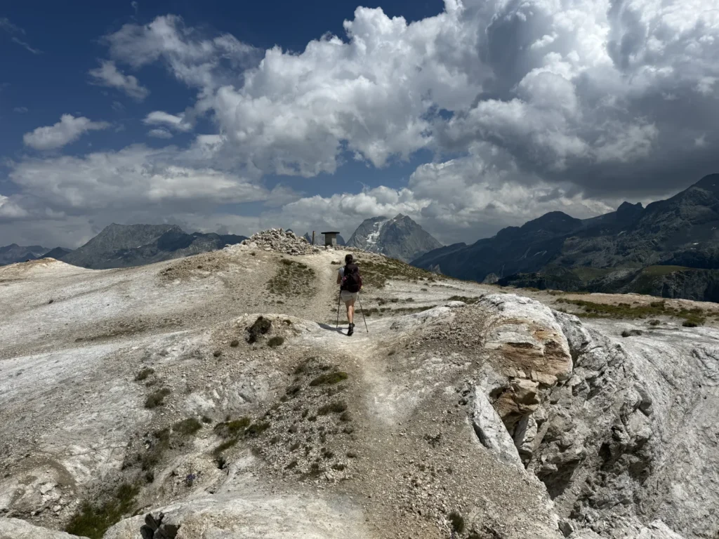
Some mountains have names that make you smile. The Petit Mont Blanc — the “Little Mont Blanc” — is one of them: no hanging glacier, no rope team, just a 2,680-metre summit sitting between Courchevel and Pralognan, whose gypsum cap turns so white in the sun that from a distance it really does look like its famous namesake.
This is a full day out. Around twenty kilometres, close to a thousand metres of ascent, and a reward that justifies every step: a 360° panorama over the Vanoise glaciers, the Grande Casse, and on a clear day the real Mont Blanc on the horizon.
Let us be upfront: this is not a family hike in the sense we usually mean on this site. Further down we explain who can realistically take it on, and which alternative to walk in the very same valley when the answer is no.
Family profile: Adventurous
| Season: Summer
| Trailhead: Le Belvédère, Courchevel Moriond
| Difficulty: Hard
The route at a glance
| Trailhead | Le Belvédère car park, Courchevel Moriond (about 1,720 m) |
|---|---|
| Summit | Petit Mont Blanc, 2,680 m (altitude on the summit signpost) |
| Ascent | about +970 m |
| Distance | about 20 km there and back |
| Duration | 6 h 30 for a fit walker; 7 h 30 quoted as the average by the tourist office |
| Difficulty | Hard — red grade. Length and ascent, not technical difficulty |
| Waymarking | Marked route no. 8 “Petit Mont Blanc” |
| Season | 1 May to 31 October depending on snow cover; safest conditions from late June to early October |
| Water | No refreshment point on the route — carry everything you need |
| Dogs | Allowed on this route, but there are grazing herds: a lead is essential |
Figures vary between sources, and that is normal: the Courchevel tourist office quotes 20.2 km, +970 m and a 7 h 30 average, while our own outing took 6 h 30 of actual walking. The difference comes down to pace, breaks and the exact starting point. Plan generously rather than tightly.
Can you do it as a family? The honest answer
We are not going to sell you this hike as an outing for the whole tribe, because it is not one. Twenty kilometres and nearly a thousand metres of ascent make for a full day of effort, on ground that is eroded in places, with no water source and no way to cut the day short once you have committed to the climb.
Who it works for: teenagers already used to walking a full day in the mountains — realistically from about 12 or 13 with several long hikes behind them — together with adults in good physical shape. This is exactly the kind of objective that defines a holiday week and that a teenager will still talk about months later.
Who it does not work for: young children, occasional walkers, and any family that simply does not want to turn a day off into a sporting objective. That is not a judgement — it is just the wrong route for that need.
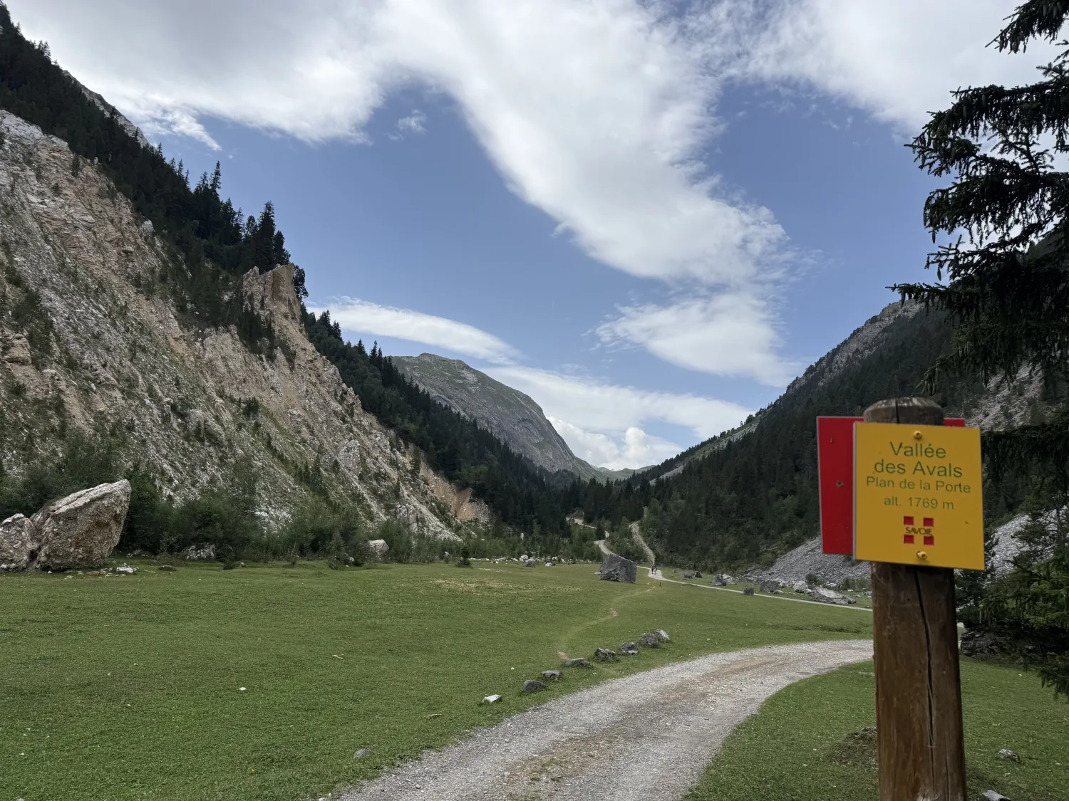
💡 The very good alternative, in the same valley. The Avals valley can be enjoyed without climbing to the summit. From Le Belvédère, the track to Plan de la Porte and beyond is wide, almost flat and genuinely beautiful: cliffs, a mountain stream, high pastures, grazing herds and marmots. Walk out as far as you like, stop for a picnic, and turn back when legs say so. Same valley, same sense of remoteness, none of the commitment. More ideas: our easy hikes around Bozel.
The rest of this article describes the full route to the summit.
Why “Petit Mont Blanc”? Gypsum and stone snow
The name explains itself as soon as you get close. Unlike its grey-rock neighbours, the Petit Mont Blanc is built of gypsum and cargneule, very pale sedimentary rocks. In sunlight its dome looks like a small, spotless white cap: a mountain that appears snow-covered in the middle of August.
This geology shapes the whole character of the place. Gypsum is soft and soluble: it hollows out, crumbles, and creates this landscape of white scree, gullied combes and dolines — funnel-shaped hollows where water simply vanishes without forming a stream. The chalky summit ground crunches underfoot in a way you will not find anywhere else nearby.
The area is protected as the Petit Mont-Blanc state biological reserve, managed by the French National Forestry Office, and is connected to the Natura 2000 “Massif de la Vanoise” network. Floristic diversity here is remarkable: over 300 plant species recorded, around a dozen of them nationally protected. A good reason to stay on the paths and pick nothing.
Getting to the trailhead: Le Belvédère and the Avals barrier
The walk starts at the Le Belvédère car park, at the end of the surfaced road climbing up from Courchevel Moriond. That is where driving stops and the Chemin des Avals begins.
One essential point: from 1 July to 31 August, motor vehicles are banned on the Chemin des Avals, beyond the barrier at the end of the surfaced Belvédère road. Cars, motorbikes and quads are all covered, and the ban is enforced. Far from being a nuisance, this is what makes the approach so pleasant — you walk up a silent valley without a single engine.
The Belvédère car park is small, so arrive early on fine summer days — which you will do anyway for a day of this length.
📍 From Bozel and the valley, allow around twenty minutes’ drive to Le Belvédère. That is one advantage of sleeping down in the valley rather than up in the resort: a 7 a.m. start stays perfectly manageable, and you are not facing a long drive home in the evening.
The route, step by step
1. The Avals valley — the approach
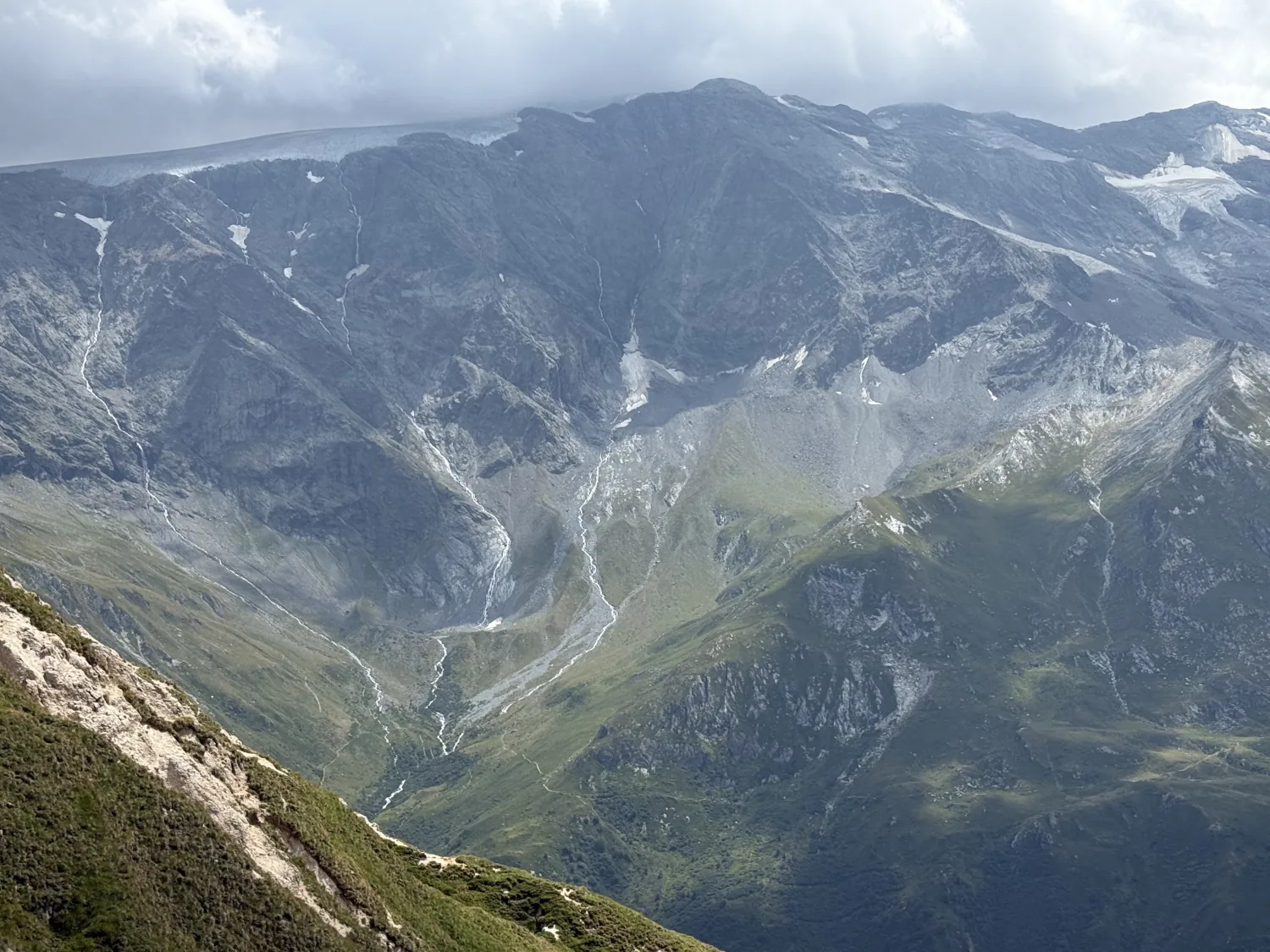
From Le Belvédère you set off along the broad Avals valley track. It starts in the forest with a short descent before the valley opens out. The scenery sets the tone immediately: tall pale cliffs, scree slopes, close-cropped meadows. The signpost Plan de la Porte, alt. 1,769 m marks the first large clearing.
You gain height gently for several kilometres. It is long but easy going: use it to warm up without pushing, because the real work comes later. Save something in reserve — this entire approach has to be walked again on the way back, at the end of the day.
2. Climbing through the combes
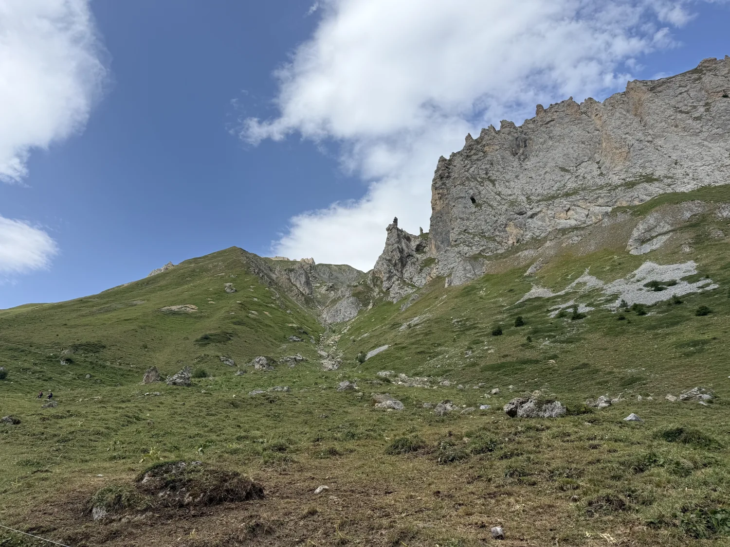
Past the wooden cross, the path turns and steepens noticeably. You climb through a superb rocky world beneath jagged walls. The gradient is steep and eroded in places: this is the hardest part of the day, and where poles start to earn their keep.
3. Towards the Col des Saulces
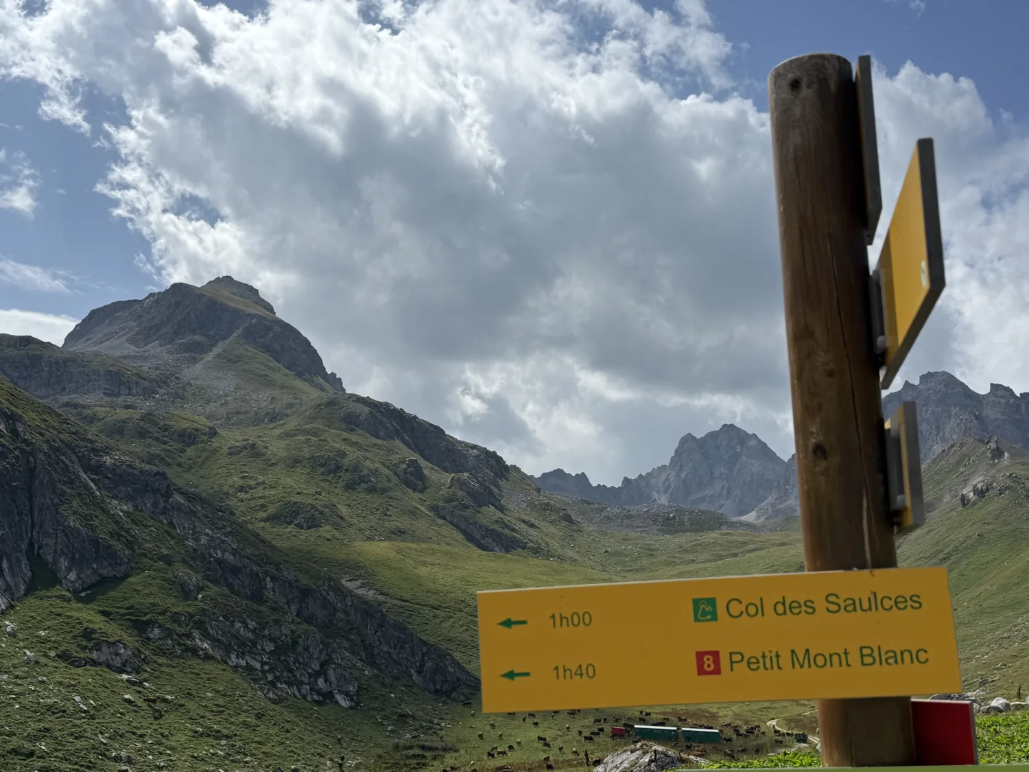
High pastures take over, dotted with grazing herds. A clear signpost gives the Col des Saulces at 1 h 00 and the Petit Mont Blanc at 1 h 40. It is a useful mental marker: from here you know exactly what remains.
4. The final metres, on the white
The ground changes colour. You leave the grass for pale, chalky, almost lunar terrain, and emerge onto an open crest where a cairn, a summit signpost and a stone orientation table stand together. That is it.
At the top: 2,680 m and the orientation table
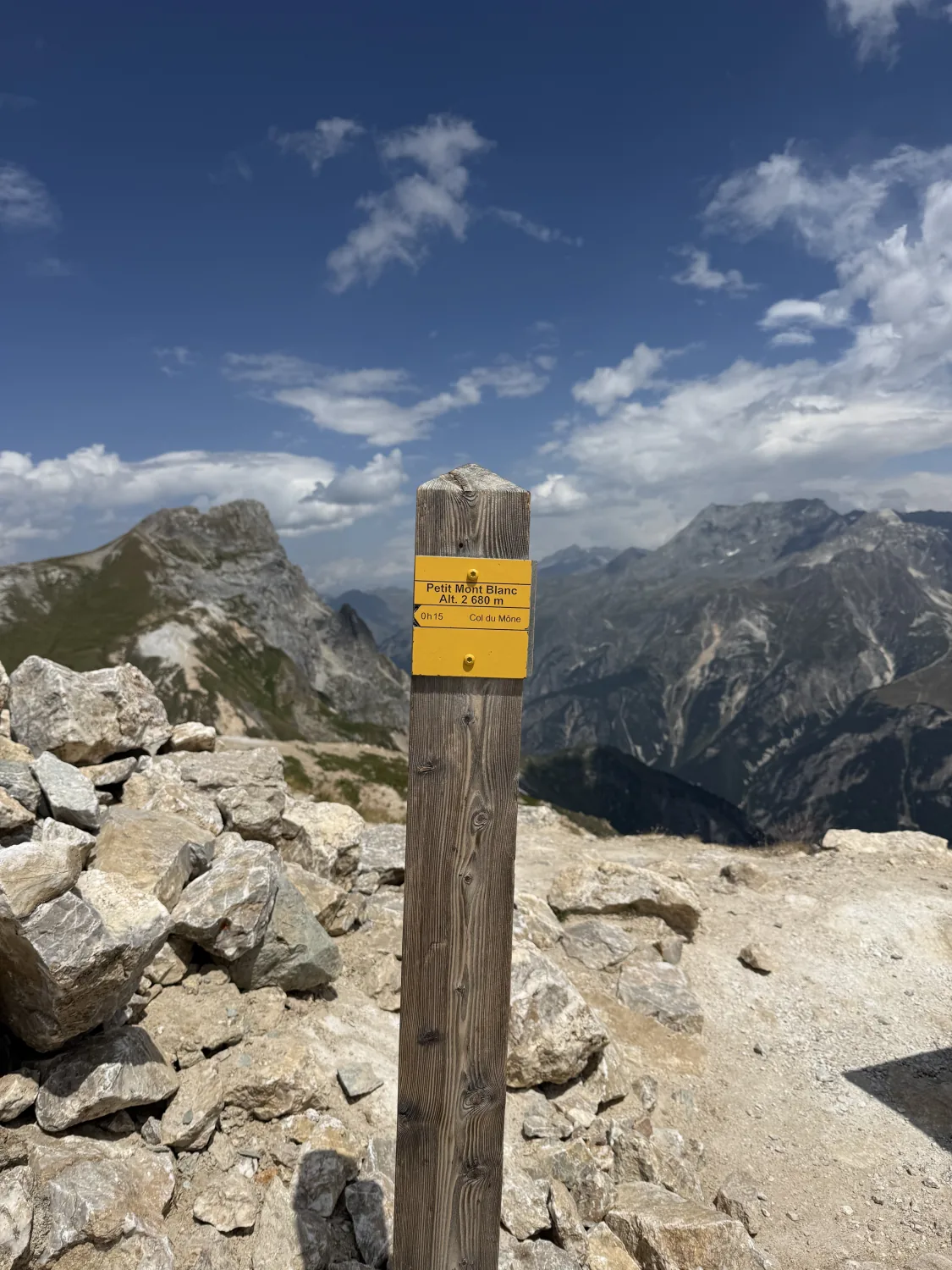
The summit signpost is unambiguous: Petit Mont Blanc, alt. 2,680 m. You will sometimes read 2,677 m depending on the source and the exact measuring point — three metres make no difference on the ground, but it is worth knowing before you debate it with another walker.
This is where the day makes sense. The view runs a full 360°. In the foreground the Grande Casse (3,855 m), the highest point of the Vanoise, raises its snow-streaked pyramid. All around lie the glaciers and combes of the massif, and far below the Pralognan and Courchevel valleys with their tiny hairpin roads. On a clear day the real Mont Blanc appears on the horizon — the joke lands perfectly.
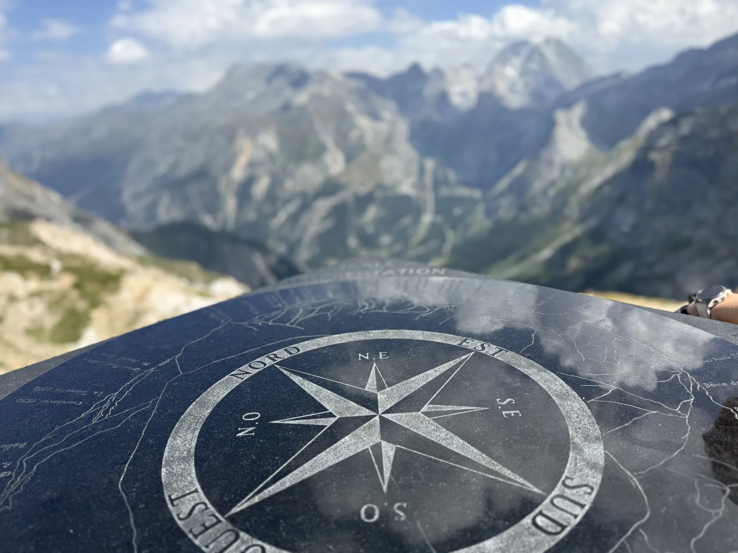
The engraved stone orientation table is a real bonus, especially with teenagers: the compass rose and the peak outlines cut into the stone let you put a name to what you are looking at, Courchevel 1850 included. This is the moment to drop the packs, get the picnic out and take your time.
The signpost also gives the Col du Mône at 15 minutes. That is the way over towards Pralognan-la-Vanoise, or towards the Grand Plan and Lacs Merlet refuges, if you are organising a traverse with a car shuttle. For a there-and-back from Le Belvédère, you return the way you came.
Wildlife and flora of the Avals valley
The Avals valley is superb for wildlife watching, and it is often what children and teenagers remember first. Marmots are plentiful in the pastures: sitting up at their burrow entrances, they whistle the alarm long before you have spotted them. With patience and quiet you may also see chamois, and higher up a few ibex.
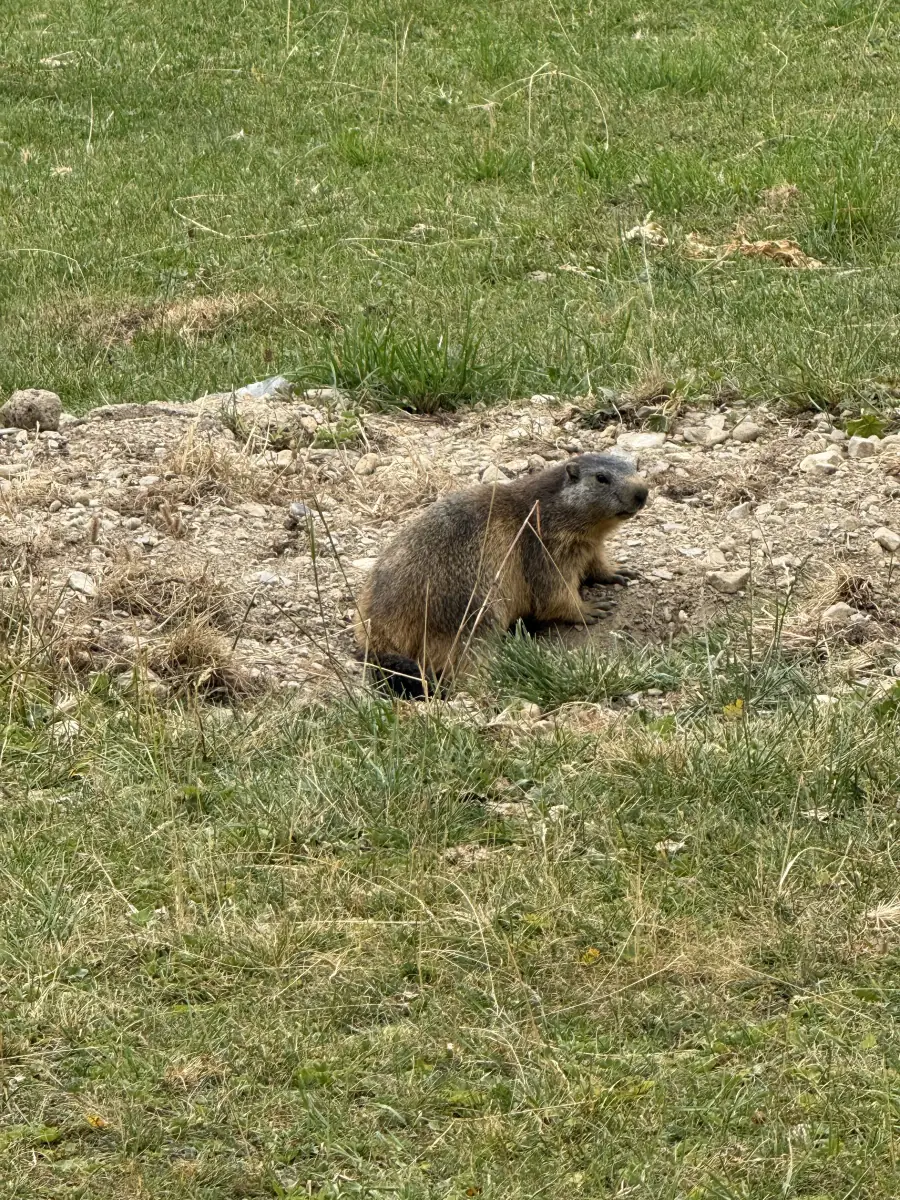
💡 Respect the wildlife. Watch from a distance, never feed marmots — visitors’ food makes them ill — and stay on the paths, all the more so in a biological reserve where protected species grow. Our detailed advice: watching marmots without disturbing them.
As for flowers, late June to mid-July is the most spectacular window: the high-altitude grasslands and gypsum slopes support a rare diversity, encouraged precisely by this unusual soil.
Our tips for a successful day
- Start early. Genuinely early. On a seven-hour day, a 7 a.m. start keeps you clear of the late-afternoon thunderstorms that are common in summer, and gives you the best light at the top.
- Check the forecast the night before and again in the morning. Wet gypsum turns slippery, and the summit crest is completely exposed to both wind and lightning. If in doubt, postpone — the mountain will still be there.
- Water, and plenty of it. There is no reliable refreshment point on the route. Reckon on at least 1.5 to 2 litres per person, more in hot weather.
- Proper boots and poles. Poles are not a gadget here: they make a real difference on the eroded sections and on the descent, where those 970 metres are paid for in the knees.
- Full sun protection. Pale gypsum reflects light like snow: sun cream, sunglasses and a hat, even under cloud.
- A windproof layer, whatever the temperature at the bottom. The summit is a bare crest, and there is almost always wind.
- Factor the return into your planning. The classic mistake is savouring the summit and forgetting that the whole Avals approach still has to be walked back — flat, but several kilometres of it, on tired legs.
Our verdict
There is nothing “little” about the Petit Mont Blanc but the name. This is a big, characterful hike, wild and generous, offering one of the finest viewpoints in the Vanoise without ever requiring you to touch rock with your hands or carry technical gear. The effort-to-panorama ratio is excellent, and the twin oddities of the place — that unreal white ground and the orientation table at the top — make it a day you remember.
To our mind it is also the right “first big summit” to offer a teenager who already walks well: long and demanding, but never dangerous or technical. The kind of day that earns a little pride.
Frequently asked questions
How high is the Petit Mont Blanc exactly?
The summit signpost reads 2,680 m, the figure also used by the Courchevel tourist office. Some sources give 2,677 m, depending on the measuring point.
Is the Petit Mont Blanc hike suitable for children?
Not for young children. At 20 km, +970 m and 6 h 30 to 7 h 30 of walking, it suits teenagers already used to long mountain days, accompanied by adults in good physical condition. To enjoy the same valley as a family, simply walk out and back along the Avals track as far as Plan de la Porte.
Can you drive up into the Avals valley?
Not from 1 July to 31 August: motor vehicles are banned on the Chemin des Avals beyond the Belvédère barrier, and the ban is enforced. Park at Le Belvédère and walk.
How long should I allow?
The Courchevel tourist office quotes 7 h 30 on average. A fit walker can do it in 6 h 30 of actual walking. Add a summit break and plan for a full day.
When is the best time to go?
The route is walkable from 1 May to 31 October depending on snow cover, but the safest conditions run from late June to early October. For flowers, aim for late June to mid-July.
Are dogs allowed?
Yes on this route, unlike the core zone of the Vanoise National Park. But you cross pastures with grazing herds, so a lead is essential — and it is better to leave your dog at home if it is not used to cattle and livestock guardian dogs.
Can you do it as a traverse to Pralognan?
Yes. From the summit, the Col du Mône is about 15 minutes away and lets you drop over towards Pralognan-la-Vanoise or towards the Grand Plan and Lacs Merlet refuges. This option needs two cars or a shuttle.
Explore further
If you enjoyed this one, here are our other ideas around Bozel, Courchevel and the Vanoise:
- our easy hikes with children around Bozel and the Vanoise, for days when you want the mountains without the effort;
- our advice on watching marmots and mountain wildlife;
- the Col de la Loze by bike from Tincave, the other great sporting challenge in the area;
- our ideas for things to do in Bozel in summer.
- the Croix de la Porcière from Le Pré, shorter than the Petit Mont-Blanc but just as panoramic (8 km, +650 m);
Staying near Bozel and Courchevel?
Le Belvédère is a twenty-minute drive away, which makes early starts considerably easier. Discover our chalet as a base camp for your hikes in the Vanoise.
Sources and things to check before you go
- Petit Mont Blanc — Courchevel Tourist Office (distance, ascent, duration, grade, season)
- Traffic on rural tracks — Courchevel Town Hall (Chemin des Avals ban)
- Rando Vanoise — Vanoise National Park itineraries
- Géol-Alp — geology of the Petit Mont-Blanc (gypsum and cargneule)
Practical information last checked: August 2026. Track closure dates, snow conditions and the weather forecast must be checked before every outing.
Thanks to David for sharing this route and these photographs.
Ma Passion Montagne · Tincave, Bozel · Savoie